Reservoir Information
Oil and gas reservoirs are the second level of data included in the Significant Oil and Gas Fields of the United States Database
A reservoir in the database is typically a single continuous pool within a producing formation. Primarily in the Gulf Coast Cenozoic (both onshore and offshore), database reservoirs can also be reservoir suites, that is two or more pools (sand bodies) in the same chrono-stratigraphic unit with no substantial vertical separation among them or with horizontal separation by sealing faults.
Database reservoirs are identified by the combination of our unique field code (the NRGID), the geologic age rank of the reservoir within its respective field, and its producing formation code. We use a standardized and expanded formation code system, standardized to facilitate aggregations and distributions of reservoir data by formation and expanded to facilitate the creation of digitized stratigraphic columns. As part of the standardization process, all local and idiosyncratic formation names have been replaced by their scientific-professional equivalent.
Four main types of reservoir information
Rock and Fluid Characteristics – Reservoir identification, volumetric, other rock, and fluids
Production and Size – Histories of production and size by product and BOE, original oil-in-place
Discovery Well – Well identification and specification of who drilled it, where and when it was drilled, and the results of this drilling
Post-Primary Recovery Methods – For oil reservoirs only
This reservoir data is combined with the general field information table to create the Reservoir Master Table (RMASTER). This table is designed to facilitate a broad variety of reservoir retrievals.
primary uses of reservoir information
- Size Distributions
- Distributions and correlations of rock and fluid properties
- Production Histories
- Recovery Growth
- Discovery Histories
An expanded list of each of these uses is provided in Retrieval Possibilities
The KnowNow retrieval system included with the field and reservoir database provides many variations of each of these primary uses
ILLUSTRATIONS OF THE USES OF THE RESERVOIR DATA
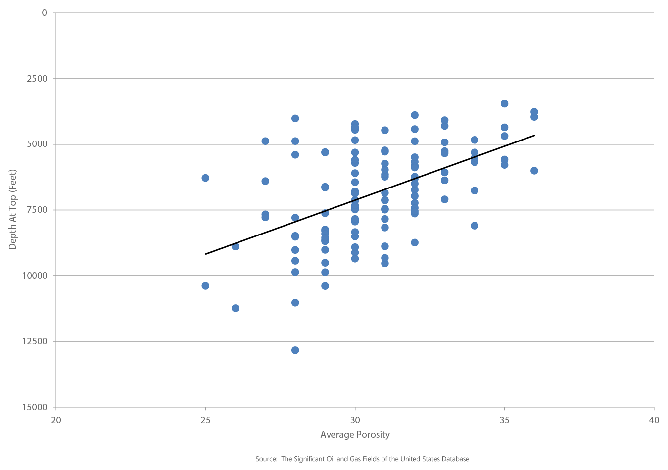
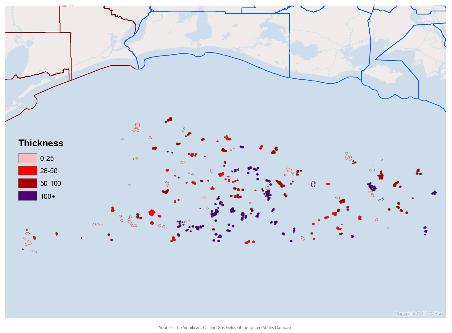
The first shows the spatial distribution of thickness by reservoir in the Gulf of Mexico Upper Pliocene Progradational Gas play. The second shows a cross-plot of average porosity and depth to top in the same play.
Spatial Thickness Distribution by Reservoir, GOM Upper Pliocene Progradational Gas Play
GOM Upper Pliocene Progradational Gas Play Depth at Top VS Average Porosity